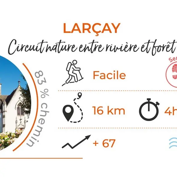
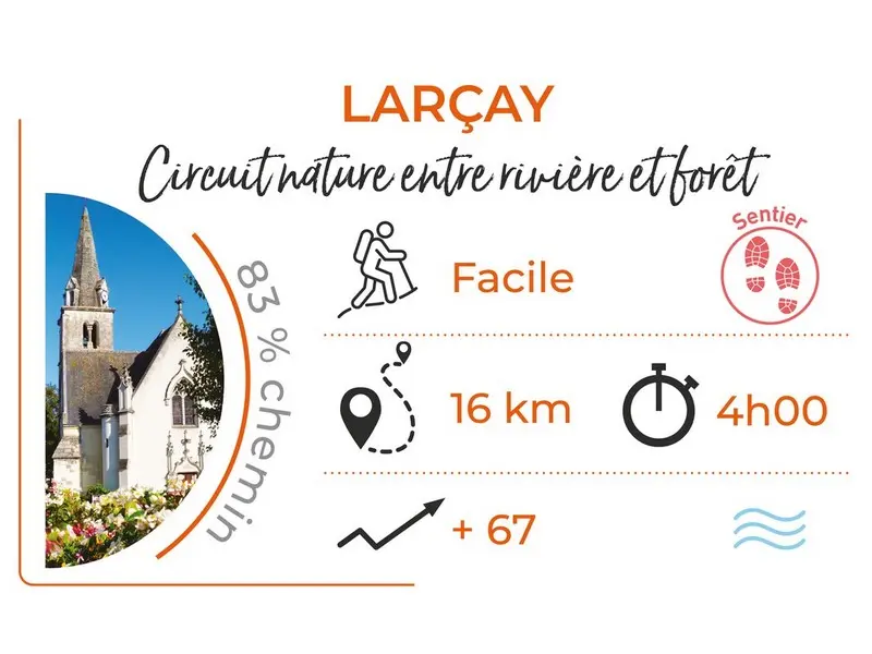
Between river and forest, you will appreciate this pleasant path of 16km .
On the banks of the Cher, Larçay is an old town with vestiges from the Gallo-Roman era. (3rd century castellum). Between river and forest, you will appreciate this pleasant path of 16km . (9,94 miles)
Read more