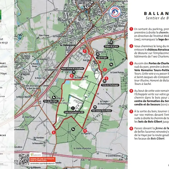
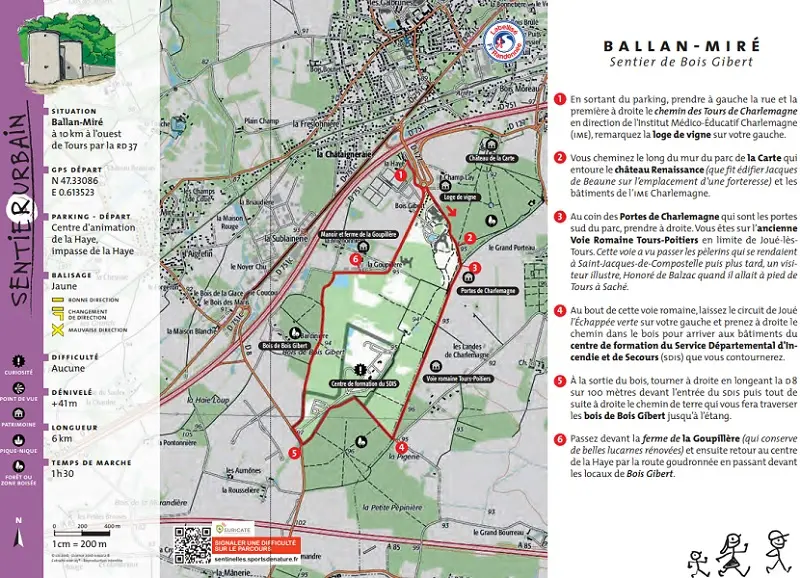
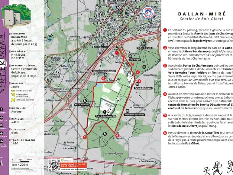
With almost a quarter of its surface area wooded, Ballan-Miré enjoys a pleasant environment, including the Cher valley. To the south of Ballan, this wooded path follows the ancient Roman road that led from Tours to Poitiers, and runs alongside the walls of the Château de la Carte, where the...
With almost a quarter of its surface area wooded, Ballan-Miré enjoys a pleasant environment, including the Cher valley.
To the south of Ballan, this wooded path follows the ancient Roman road that led from Tours to Poitiers, and runs alongside the walls of the Château de la Carte, where the so-called Charlemagne towers still stand.
Tours Métropole hiking trail.
Read more