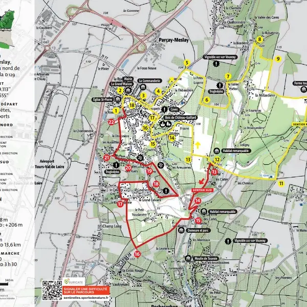
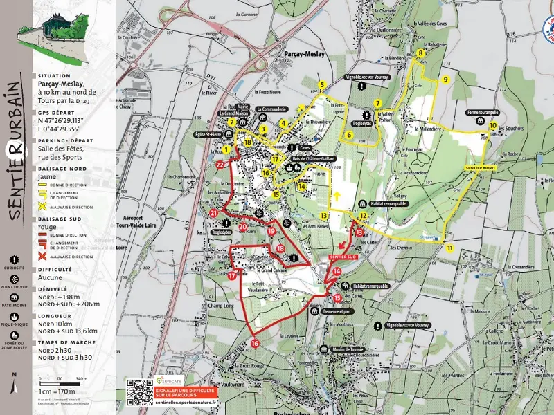
Parcay-Meslay is situated at the heart of major transport routes, but has nevertheless retained its rural character, with its Vouvray AOC vineyards and its remarkable built heritage, including the Grange de Meslay.
After exploring the old buildings in the town centre, this route takes in rolling cou
Parcay-Meslay is situated at the heart of major transport routes, but has nevertheless retained its rural character, with its Vouvray AOC vineyards and its remarkable built heritage, including the Grange de Meslay.
After exploring the old buildings in the town centre, this route takes in rolling countryside dotted with vineyards. The alternative route continues towards the neighbouring commune of Rochecorbon, between the Loire and the hillsides.
Read more