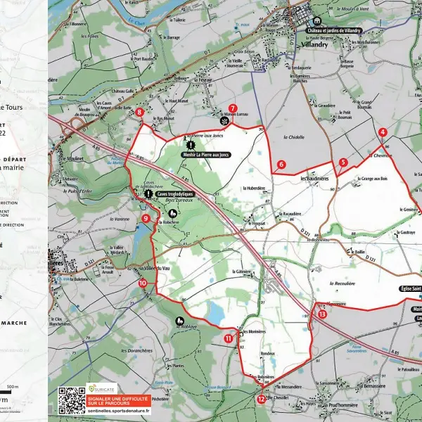
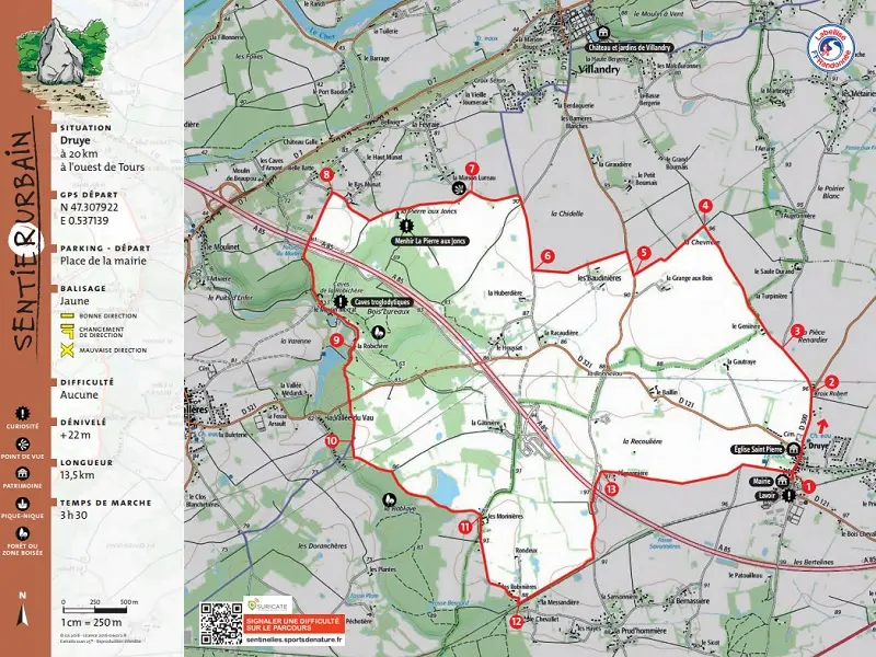
The ‘Champagne’ landscape offers broad horizons punctuated by the wooded massifs that occupy a quarter of the territory of Druye, whose Gallic name means ‘oak’. This trail leads to the menhir of the Pierre aux Joncs and allows you to discover the diversity of the local villages.
The ‘Champagne’ landscape offers broad horizons punctuated by the wooded massifs that occupy a quarter of the territory of Druye, whose Gallic name means ‘oak’. This trail leads to the menhir of the Pierre aux Joncs and allows you to discover the diversity of the local villages.
Details of the trail and its stages can be downloaded in PDF format.
Read more